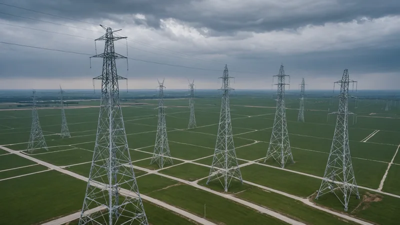
Three months ago, a contractor cleared vegetation 40 feet into a transmission easement. The next scheduled patrol was six weeks away. By the time the helicopter crew saw the change, the work had already altered access, disturbed the ground, and created a documentation problem for the operator.
That gap is not a sign that transmission operators are ignoring their corridors. Scheduled overflights persist because they solve several difficult problems at once. A crew can cover a long right-of-way in a single sortie, inspect conditions from a useful angle, and return with photographs that maintenance and compliance teams understand. The schedule is familiar, budgetable, and connected to existing operating procedures.
It is also an incomplete observation system. A quarterly patrol is a detailed look at one point in time. The corridor keeps changing between those points.
Why scheduled overflights remain the baseline
Transmission rights-of-way are difficult places to monitor continuously. They cross private property, wooded terrain, wetlands, roads, rail lines, and areas with limited ground access. A patrol aircraft can follow the line, adjust its altitude and viewing angle, and record conditions that are difficult to interpret from a single overhead image.
Most operators run some combination of quarterly and semi-annual patrols, with additional flights after storms, outages, construction activity, or reported conditions. The exact cadence depends on the asset, terrain, vegetation growth, access, and internal risk tolerance. The operating pattern is usually more nuanced than "inspect every three months." Some segments receive closer attention because they pass through dense vegetation or populated areas. Others are covered through a broader routine cycle.
The flight itself is only one part of the process. Operations teams plan the route, coordinate aircraft and crew, account for weather and airspace, collect imagery, review findings, assign work, and retain evidence. Flight planning must follow applicable FAA rules and local airspace requirements. A survey that is technically possible may still be delayed by wind, visibility, wildfire restrictions, temporary flight restrictions, or aircraft availability.
For reliability work, this activity also sits alongside formal vegetation management and condition assessment programs. NERC reliability requirements, including the FAC-003 vegetation management standard for applicable transmission facilities, make the quality of inspection records and corrective action important. They do not remove the practical constraints of getting an aircraft or crew over every segment at the desired interval.
That is why scheduled overflights have staying power. They fit the way corridor work is funded, staffed, reviewed, and documented.
The interval is the blind spot
The operational weakness appears between visits. A new structure can go up near the right-of-way. A landowner can grade a track or pile material beneath a line. Fast-growing vegetation can move from acceptable clearance to a work-order condition before the next flight. A storm can wash out a slope or expose a foundation without producing an immediate outage.
These events do not all have the same urgency, but they share a characteristic: they begin on a schedule that does not match the patrol schedule.
A quarterly flight gives an operator strong evidence for the day of inspection. It does not automatically answer what changed in the intervening weeks. When the next crew arrives, the team may see the result without knowing whether it is new, whether it has progressed, or whether it was already present during the prior visit.
That makes change detection more difficult than simple image review. The useful question is not only, "What is visible here?" It is also, "What is different from the last reliable observation, where is it relative to the asset, and does it warrant a field response?"
Traditional workflows often distribute the answer across flight folders, spreadsheets, GIS layers, email threads, and work management systems. Each tool may be reasonable on its own. Together, they make it harder to maintain a consistent spatial record, especially when imagery arrives from multiple aircraft, contractors, satellite providers, or fixed sensors.
What a spatial view adds between flights
At Larx, we are building around the gap between raw collection and operational decision-making. The product brings imagery, video, and sensor feeds into one spatial view, so a team can examine a corridor as a changing place rather than as a series of disconnected files.
That distinction matters in several practical ways:
- Common location: Flight video, orthographic imagery, satellite scenes, and sensor observations can be reviewed against the same corridor geometry, structures, spans, and access points.
- Change context: A suspected vegetation encroachment or ground disturbance can be compared with earlier observations instead of being treated as an isolated image.
- Prioritization: Teams can separate a new structure near a line from a low-consequence land-cover change elsewhere in the right-of-way.
- Handoff: A finding can carry its location, source imagery, time, and notes into the conversation between monitoring, vegetation management, engineering, and field crews.
In an early-access pilot with a mid-Atlantic transmission operator, the first confirmed encroachment event appeared in satellite imagery three weeks before the next scheduled patrol. The satellite scene did not replace the patrol. It gave the team an earlier signal, helped them review the surrounding parcel, and supported a targeted field check rather than waiting for the next full route.
This is the useful role for satellite data in corridor monitoring. It can provide a more frequent screening layer across a large area. It can also help identify where the next close inspection should concentrate. Commercial revisit cadence, cloud cover, resolution, viewing angle, and vegetation conditions still determine what can be seen. Satellite imagery is not equally useful for every event or every corridor.
From a corridor-wide screen to a field action
A monitoring program becomes more useful when it connects detection to a defined action. Consider a 115-kilovolt line passing through mixed forest and agricultural land. The operator has a quarterly helicopter patrol, a vegetation management contractor, and occasional reports from landowners. Between patrols, the team receives a new satellite scene and a sensor alert associated with a nearby access road.
On a map, the satellite comparison shows a rectangular area of cleared ground within the right-of-way. The video from the previous overflight shows no comparable activity. The sensor feed provides a time window for vehicle movement, but not a complete explanation. The team can then review the parcel boundary, tower locations, span geometry, access route, and prior observations in one place.
The next step may be a field visit, a call to the landowner, a request for contractor records, or simply continued observation. The point is not to declare an incident from a single image. The point is to reduce the time spent assembling context before deciding what to do.
The same workflow applies to smaller events: a new shed or crane near the easement, a road cut that changes drainage, stored materials beneath a conductor, or a washout that threatens access to a structure. Each finding needs location and context before it becomes a reliable work item.
For a small monitoring team, this also changes how review time is spent. Instead of watching every minute of every corridor video with equal attention, reviewers can use broader coverage to identify candidate areas, then inspect the relevant flight segment and historical evidence. That is not a replacement for judgment. It is a way to reserve judgment for the places where it matters.
What satellite and sensors cannot provide
We are not saying satellite imagery at current commercial revisit cadences can replace the close-range physical access a patrol crew provides for tower hardware inspection. We are not saying it can. A satellite scene will not reliably show a cracked insulator, a loose fitting, conductor condition, or every vegetation issue hidden below a canopy. A sensor alert may indicate movement or environmental change without explaining the cause.
Aircraft and field crews remain necessary for detailed inspection, confirmation, measurement, access assessment, and corrective work. A crew may need to identify species and height, verify clearance, inspect a slope, document a structure, or determine whether a reported change is inside the easement. Those tasks require better resolution, the right viewing angle, and sometimes boots on the ground.
There are other limits. Cloud cover can block optical satellite imagery. Seasonal shadows can complicate comparisons. A new disturbance may be too small to identify confidently. A corridor under heavy canopy can hide activity. Sensor feeds can produce alerts that need calibration and local interpretation. A spatial platform does not remove these uncertainties. It makes them easier to see alongside the source data.
The boundary is important because false confidence is expensive in infrastructure operations. A map that looks complete is not the same as an inspection that is complete. The right system should show the evidence, its age, its source, and the remaining question.
A practical monitoring cadence
For most operators, the answer is not to discard scheduled overflights. It is to place other observations around them and use each source for the job it handles best.
| Monitoring layer | Useful role | Typical limitation |
|---|---|---|
| Scheduled aircraft patrol | Detailed corridor review, visual evidence, and targeted inspection | Weather, airspace, aircraft availability, and long intervals between flights |
| Satellite imagery | Broad screening for land-cover change, construction, and disturbance | Cloud, resolution, revisit timing, and canopy limitations |
| Fixed or mobile sensors | Signals tied to movement, environment, access, or local conditions | Alerts require interpretation and may not identify the physical cause |
| Field response | Confirmation, measurement, repair planning, and documentation | Cost, travel time, access, and limited coverage per visit |
The operating improvement comes from making these layers speak to one another. A patrol should inform what the satellite comparison looks for. A satellite change should help decide where a crew goes next. A sensor alert should be reviewed with nearby imagery and asset context. A field result should be recorded so the next comparison starts with better information.
This is the problem we are working on with Larx as a three-person team. We are not trying to make a flight schedule disappear. We are trying to make the weeks between flights less opaque, using the imagery, video, and sensor feeds teams already collect or can reasonably add to their programs.
If you want to see how Larx handles corridor imagery ingestion, we will show you the actual pipeline during a call, including how a flight video, satellite observation, and sensor event are tied to the same spatial record. The useful test is not whether a map looks impressive. It is whether a reviewer can move from a detected change to a defensible next action without rebuilding the corridor history by hand.
On the next patrol, the crew will still inspect the line from the air. The difference is that the team does not have to treat that flight as the first moment when the corridor becomes visible again.