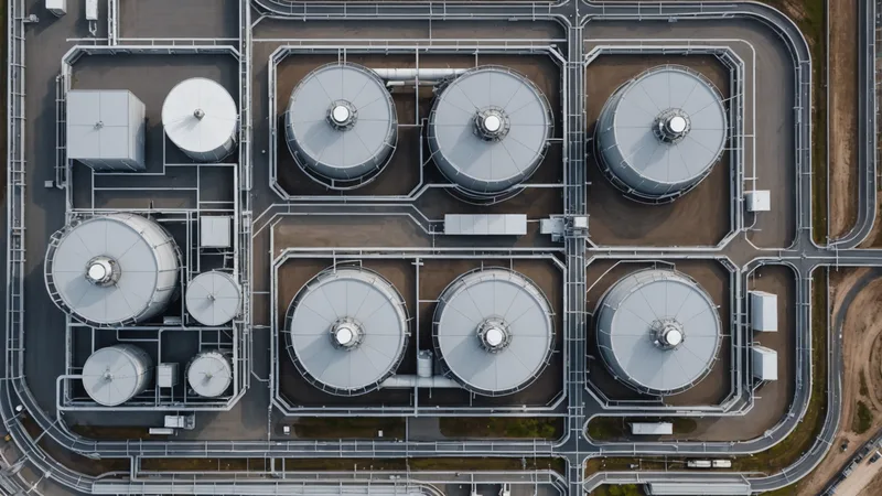
A sixty-site inspection backlog is not a staffing problem. It is a prioritization problem. Utility operations teams do not usually fall behind because they have no field capacity. They fall behind because a scheduled inspection rotation treats every site as equally likely to have changed.
That assumption is easy to understand. Inspection programs often blend regulatory requirements, internal operating standards, and practical limits on crew availability. A distribution asset, pump station, substation, stormwater BMP, or easement enters a queue because its inspection cycle says it is due. The queue rarely knows which site has new evidence of deterioration, encroachment, flooding, access damage, or vegetation pressure.
The result is a familiar operational pattern: a three-to-six month backlog of sites waiting for visual assessment, while field crews spend time revisiting locations that have changed very little. The answer is not to abandon scheduled inspections. It is to add a condition-based layer that helps teams decide which site deserves the next available visit.
The backlog hides different kinds of risk
A site on an inspection list is not a risk category. It is an administrative state. Two assets can be equally overdue and require completely different responses.
One may be a fenced substation with stable imagery, normal perimeter sensor readings, and no recent work orders. Another may be a low-lying pump station where imagery shows standing water near an access road, a telemetry reading has become intermittent, and the last field visit occurred before a major storm. Both appear as "due" in an asset management system. They should not occupy the same place in a dispatch queue.
This distinction matters because utility inspection work is expensive in ways that do not always appear in the work order. A crew may need traffic control, a site escort, specialized equipment, or a long drive between dispersed assets. Some locations are on leased property, reached through easements, or constrained by right-of-way conditions. When a visit is scheduled without a current view of site condition, the crew can arrive to find that the work is either lower priority than another site or impossible to complete safely.
Spatial data fusion gives the operations lead a way to sort those decisions using more than due dates. The goal is not to create a perfect condition score. The goal is to bring relevant evidence into one spatial view, then use that view to separate routine visits from locations that warrant earlier attention.
What fusion adds to an inspection queue
Most utility programs already have useful data. GIS contains asset locations and boundaries. Satellite imagery provides a repeated view of the surrounding ground and structures. SCADA and other sensor systems record operational signals. Work orders show where crews have found issues before. Inspection history indicates how long a site has gone without a physical visit.
These sources are often maintained in different systems, with different identifiers, update schedules, and levels of precision. The operational challenge is not simply collecting more feeds. It is aligning the feeds to the same site and making the relevant changes visible to the person deciding what happens next.
For a distribution asset, the useful view may include:
- Recent imagery compared with an earlier baseline, focused on the asset footprint and access area.
- Sensor telemetry or SCADA signals that fall outside the normal pattern for that location.
- Open work orders, prior inspection findings, and the time since the last physical visit.
- Nearby changes such as new construction, vegetation growth, erosion, standing water, or apparent encroachment.
- Access constraints, easement boundaries, and the route a field crew would need to take.
Each signal has limitations. Imagery may show a changed surface without explaining the cause. A sensor may report a value outside its expected range because of a communications problem. A work order may remain open after the underlying issue has been resolved. Fusion does not eliminate those ambiguities. It places them together so an operations lead can judge whether the combination is strong enough to move a site up the queue.
A practical triage view might divide sites into three working groups:
| Priority | Typical evidence | Operational response |
|---|---|---|
| Immediate review | Multiple signals indicate a possible change, safety issue, or service risk. | Validate the evidence and dispatch or escalate according to the operating procedure. |
| Planned field visit | Imagery or telemetry suggests a change, but the consequence and timing are uncertain. | Assign the site to the next suitable crew route and specify what to verify. |
| Routine cycle | No material change is visible and recent operational records remain consistent. | Keep the site in its normal inspection program while preserving the review record. |
A synthetic example from a distribution program
Consider a mid-Atlantic distribution utility in an early-access program. Its operations group had a backlog of sites due for visual assessment, including pole-line access points, small substations, and equipment near drainage channels. The group could not send a crew to every location in the same week, and the existing queue was primarily ordered by inspection date.
One access point had been inspected several months earlier and had no open corrective work order. A new satellite image showed a pale, irregular area extending from the edge of the right-of-way toward the equipment pad. The change was not enough to identify a failure. It could have been exposed soil, grading work, or a seasonal condition. But the same site had a recent series of intermittent telemetry gaps, and the route to the asset crossed an area where heavy rain had previously limited access.
That combination changed the dispatch question. Instead of asking whether the site was simply due, the operations lead could ask what a crew needed to verify: whether water had reached the pad, whether the access route remained passable, whether the telemetry issue was local or communications-related, and whether any visible condition required a work order.
Another site in the same queue showed no meaningful visual change, stable readings, and a recent completed inspection. It remained due under the formal program, but it did not need to compete with the first location for the next available crew. The team could group routine sites into an efficient route while sending the uncertain site to a crew with the right equipment and instructions.
This is a modest change in workflow, but it can improve the quality of every field visit. The crew arrives with a specific question rather than a generic instruction to "inspect site." The operations lead has a reason for the priority. The resulting observation can be tied back to the imagery, telemetry, and inspection history that informed the decision.
When satellite triage is not enough
The triage model only works if the signals are interpreted within the operating program. Satellite imagery cannot confirm the torque of a connection, the condition of a valve, the integrity of a below-ground pipe, or the presence of a developing electrical fault that leaves no visible surface indication.
Some visits should remain mandatory regardless of what the remote view shows. Regulatory inspections, safety checks, post-incident assessments, and work involving concealed or hazardous conditions require physical verification. A clear image does not waive an inspection requirement. Nor should a normal sensor reading delay a visit when a known failure mode demands direct examination.
There are also conditions that can make imagery misleading. Cloud cover, shadow, seasonal vegetation, image resolution, and the angle of collection can obscure the feature an analyst needs to see. A changed patch near a pump station may be construction activity, sediment, or an artifact of different image conditions. A missing object may reflect occlusion rather than removal.
For that reason, a fused view should produce a reviewable reason for priority, not an automatic work order. The right next step may be a second image, a telemetry check, a phone call to a site contact, or a physical visit. The system should preserve the uncertainty and the evidence that created it. That makes triage useful without pretending that remote data can replace field judgment.
Make the result usable for dispatch
Operations teams do not need another map that requires a specialist to interpret it. They need a view that connects a location to a decision. A triage result should answer four practical questions:
- What changed, and compared with which baseline?
- Which data sources support the change signal?
- What is the consequence if the condition is real?
- What should the field crew verify when it arrives?
The last question is especially important. A priority list without field instructions simply moves the bottleneck from scheduling to interpretation. If the evidence points to possible erosion near an easement, the work order should identify the area to examine. If the concern is a telemetry anomaly at a remote pump station, the crew should know whether to check the local instrument, power supply, communications equipment, or surrounding site condition.
In the platform, we keep inspection history at the site level so the triage result can include how long it has been since the last visit, not just whether the satellite saw a change. That context helps distinguish a new signal at a recently inspected location from the same signal at a site that has not been visited in months. It also gives the team a record of why a location moved up or down in priority.
For a small operations group, this record supports a practical feedback loop. A crew confirms that a visible change was harmless, and the next review can take that finding into account. A crew discovers damaged drainage, unauthorized activity, or an access problem, and the site can be associated with a corrective work order. Over time, the value is not only in the current queue. It is in making the inspection program more informed at the next cycle.
The baseline determines whether triage deserves trust
Condition-based dispatch does not remove the need for a formal inspection cycle. It gives that cycle a better starting point. The approach succeeds when the utility can distinguish a real change from a stale record, a data error, or a normal seasonal variation.
That makes baseline quality the central dependency. Asset locations need to be accurate enough to connect imagery, telemetry, work orders, and inspection records to the same place. Site boundaries need to reflect the area that matters, including access routes, drainage features, and relevant easements. Timestamps need to be clear. Historical imagery and inspection findings need to remain available for comparison. Sensor identifiers need to map to the assets that operations staff recognize.
If those foundations are inconsistent, fusion can create a more complicated queue without creating a better one. If they are maintained, even a small team can use remote evidence to focus scarce field time where a visit is most likely to matter. The backlog does not disappear. It becomes a managed set of decisions grounded in a current, trustworthy spatial baseline.